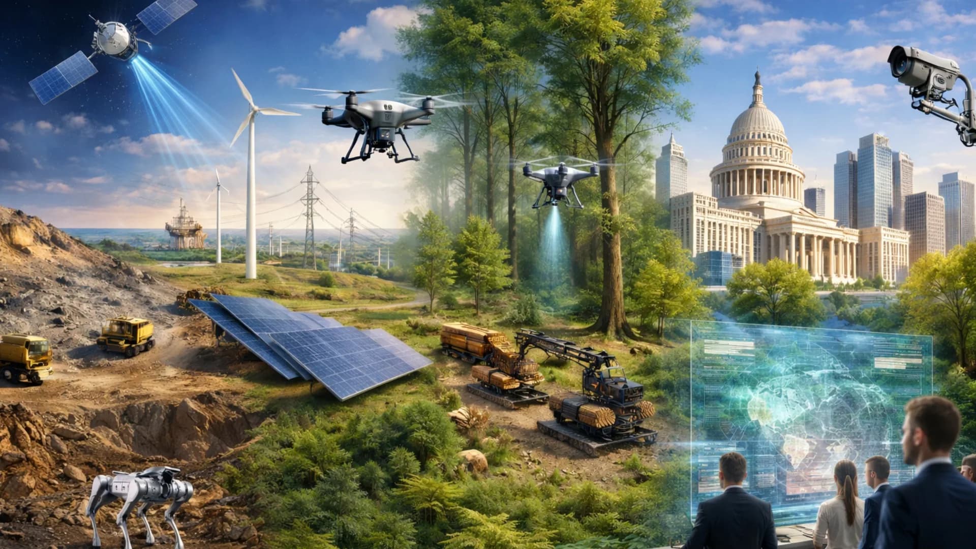
Satellite services and remote sensing
At Tecnoseg SpA we offer personalized management and advisory in satellite solutions, adapted to the specific needs of each client and the reality of their industry.
Our service is designed to deliver a comprehensive vision, considering the market, the organization's structure and the objectives of each project.
With this approach, we help companies and entities from various sectors develop sustainable, strategic and globally impactful projects.
Satellite intelligence for strategic industries
At Tecnoseg SpA we develop a satellite technology management and advisory service based on strategic planning, technical analysis and continuous support.
Each project is designed in a personalized manner, optimizing the use of satellite images to maximize their operational and strategic utility.
Our main services
Satellite management services oriented to planning, advisory and comprehensive administration of the satellite image acquisition and processing process, ensuring resource optimization and quality of geospatial products.
Assistance in managing urban growth and infrastructure expansion. Facilitates informed decisions on land use, zoning, drainage and sustainable development.
Aplicaciones: urban expansion, civil works, cadastres and impact studies.
Strategic surveillance of critical zones through optical and radar (SAR) satellite imagery. Delivers updated information that reinforces planning capacity and operational response to threats or intrusions.
Aplicaciones: borders, critical infrastructure, perimeter control and territorial and coastal surveillance.
Provision of satellite and radar images in real time for rapid response to natural disasters or emergencies. Facilitates coordination of evacuations, rescues and post-event damage assessment.
Aplicaciones: fires, floods, landslides, earthquakes, eruptions and extreme events.
Subscription service with automatic detection of changes in terrain or infrastructure. Combines high-revisit satellite images with artificial intelligence algorithms. Benefit: enables immediate reaction to operational or environmental variations.
Aplicaciones: mining, energy, forestry, territorial security and environment.
Creation of dynamic three-dimensional models that integrate satellite, UAV and ground sensor data. Allows simulation, planning and anticipation of changes in mines, plants or infrastructure projects.
Aplicaciones: operational planning, predictive maintenance and geotechnical risk assessment.
Catalog: historical images for baselines, audits or temporal comparisons.
Scheduled: new acquisitions under customized conditions (date, coverage, angle and cloudiness).
From space to decision
Nuestro proceso incluye:
Diagnosis and planning: Analysis of objectives, area of interest (AOI) and specific client needs.
Image selection and acquisition: Selection of satellite sources (catalog or scheduled) optical or SAR.
Processing and analysis: Conversion of data into useful information through AI, radar and multispectral analysis.
Delivery and report: Results in GIS formats with technical interpretation and recommendations.
Follow-up and monitoring: Continuous support and automatic alerts for detected changes.
World-class satellite technology
At Tecnoseg SpA we integrate advanced satellite technology with a high-level multidisciplinary team to transform geospatial data into safe, fast and accurate decisions.
Optical images
SAR radar (synthetic aperture radar)
Artificial intelligence (AI)
Terrain modeling
Proprietary processing platforms
GIS tools (geographic information systems)
Traceability and validation systems
Our commitment
Sustainable environmental monitoring
We use satellite technology to monitor and protect ecosystems, water bodies and natural resources in a non-invasive way.
Precision and reliability
We work with the best satellite data sources and validated methodologies to ensure precise and reproducible results.
Information security
We handle sensitive geospatial data with the highest security and confidentiality standards.
Tecnoseg SpA: innovation + security = trust
Clean, safe and environmentally friendly technology
High specialization in risk zones
Internationally qualified personnel
Procedures adapted to each project stage
Significant reduction in time and costs
Pioneer technological integration in the industry
Guaranteed certification and traceability
¿Listo para tu próximo proyecto?
Take your project to the next level with satellite intelligence