Topography and LiDAR
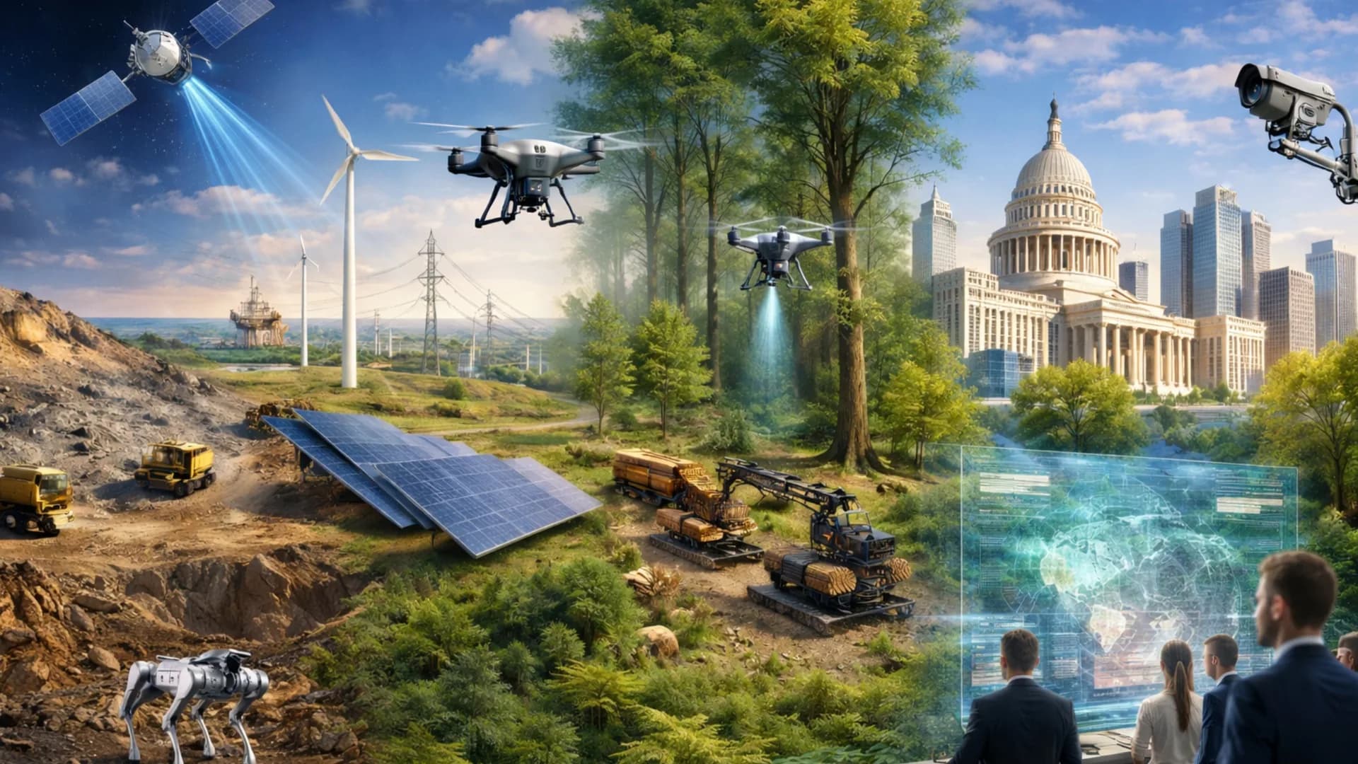
At Tecnoseg SpA, we combine GNSS RTK, robotic total stations, aerial and terrestrial LiDAR, satellite imagery and UAV photogrammetry in traceable digital workflows, integrating each data point in a validated and traceable digital flow.
We guarantee centimetric precision, field efficiency and results ready for engineering, mining and public works. Tecnoseg Topography — Precision that builds trust.
What do we do?
We apply a comprehensive topographic methodology that combines terrestrial and aerial instrumentation with geodetic control and advanced digital processing.
We transform terrain data into precise, traceable information ready for engineering, planning or construction control, ensuring coherence between field, office and final design.
Centimetric precision for large-scale projects.
Our main services
High-density point cloud acquisition using LiDAR sensors mounted on UAV drones. They allow modeling of natural terrain, vegetation and structures with millimetric precision, even in hard-to-reach areas or with dense coverage.
Mobile and stationary laser scanning to model surfaces, tunnels, interiors or structures with three-dimensional detail. SLAM technology allows data capture in complex environments without requiring direct line of sight, generating precise and georeferenced 3D models.
Field data capture using GNSS and total station to generate base plans, contour lines and digital terrain models with guaranteed precision.
Positioning and verification of construction elements, ensuring agreement between design and execution.
Calculation of earthwork volumes, piles or stockpiles, integrating UAV data and terrestrial measurements for verifiable results.
Post-construction surveys to validate the location and dimensions of works, installations or utility networks.
Implementation of GNSS networks and control points linked to official frameworks, ensuring coherence and traceability.
Stability control in dams, slopes and structures through high-accuracy differential leveling.
Our process
Nuestro proceso incluye:
Technical planning and field coordination: We define the survey scope, reference systems and most efficient capture methodology according to terrain and project objectives. Control points, routes and observation zones are established, ensuring geodetic coherence from the start.
Equipment installation and calibration: We configure total stations, GNSS RTK and LiDAR sensors according to required tolerances. Each piece of equipment is calibrated in the field and validated with independent control points to ensure centimetric precision.
Topographic and geospatial data capture: We perform field surveys using GNSS observations, laser scanning or UAV photogrammetry, as appropriate. All records are georeferenced in real time and documented for complete traceability.
Processing, validation and quality control (QA/QC): Data is processed in specialized software (Topcon Magnet, Trimble Business Center, LiDAR360, Pix4D, among others), applying filters, corrections and network adjustments. Results are validated through cross-control comparisons and positional accuracy verification.
Product delivery and technical review with client: We deliver plans, digital models, contour lines, point clouds and control reports, compatible with CAD, GIS and BIM. We include a technical review session where results and field observations are validated.
Our technology and personnel
Precision technology, expert operators and human judgment:
Robotic total stations:
High-accuracy equipment for angular and distance measurements in any condition.
GNSS RTK systems:
Own geodetic networks with real-time correction for centimetric positioning.
LiDAR scanners:
Aerial and terrestrial sensors with SLAM workflows for massive point capture with millimetric precision.
Photogrammetric UAVs:
Drones with high-resolution multispectral sensors for aerial surveys.
Data integration:
Compatibility with satellite imagery and CAD / GIS / BIM platforms.
Professional software:
Calculation, modeling and geodetic network adjustment tools.
Technical team:
Professionals with training in geomatics, geodesy and applied engineering.
Our commitment
Committed to precision, safety and trust in the field.
Guaranteed accuracy and traceability
Each survey is executed under geodetic control, QA/QC validation and reference protocols that ensure centimetric precision and coherence throughout the data flow.
Operational safety and professionalism
Our teams apply certified procedures in the field, prioritizing the safety of people, infrastructure and the environment where measurements are performed.
Sustainability and environmental respect
We perform responsible operations, minimizing environmental impact and optimizing human and technological resources in each project.
Innovation with technical responsibility
We adopt emerging technologies—LiDAR, GNSS, UAV and satellite—with validated technical criteria, ensuring reliable, verifiable and applicable results.
Why choose us?
Tecnoseg SpA: Precision, experience and technology at the service of the terrain.
Proven experience in topographic and geodetic surveys for mining, energy, public works and infrastructure
Integrated multi-source technology, combining GNSS, total stations, aerial and terrestrial LiDAR, UAV and satellite in a traceable digital flow
QA/QC quality control at all stages, ensuring centimetric precision and coherence between field, office and final delivery
Highly qualified technical personnel, with training in topography, geomatics and applied geodesy
Standardized and traceable processes, backed by safety protocols and certified operational methodologies
Professional deliverables compatible with CAD, GIS and BIM environments, ready for design and construction
Permanent commitment to innovation, efficiency and environmental respect
Get precise topographic data for your project
Our topography team is ready to support your project with cutting-edge technology.